
Climbing Mount Rundemanen
- Sep 8, 2016
- 4 min read
Roger and Wendy Forsey had a bit of an adventure climbing Mount Rundemanen, near Bergen!
It was a sunny day when we landed in Bergen on Tuesday afternoon. After that, it rained every day. Wednesday was the worst – we had been gone up the road in the rain for only five minutes before turning back, wet through. We were wearing our Rainbird jackets and using an umbrella, but not our waterproof pants. We found out today that Bergen has set a new record for rainfall in July. The amount of precipitation was 60 percent over what’s considered normal for July.
Mount Floyen is one of the 7 city mountains in Bergen and one of the city's most popular tourist attractions. Each day it was obscured by mist or rain, so we visited the other tourist attractions in Bergen.
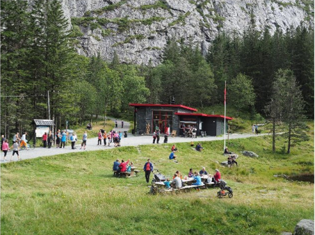
On Sunday, the weather forecast was for a sunny day, with no rain, so we went up the Fløibanen funicular to Floyen. The Fløibanen funicular in Bergen starts its climb up Mount Fløyen 150 m from Fisketorget – the fish market located on the Bergen docks.

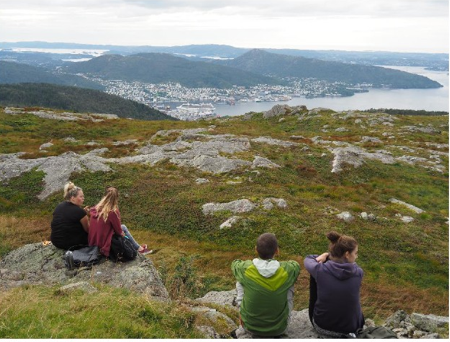
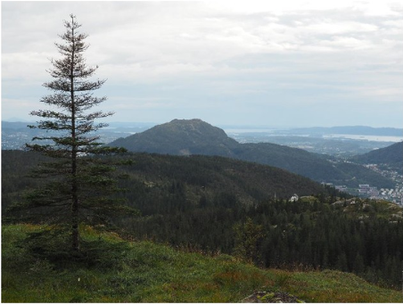
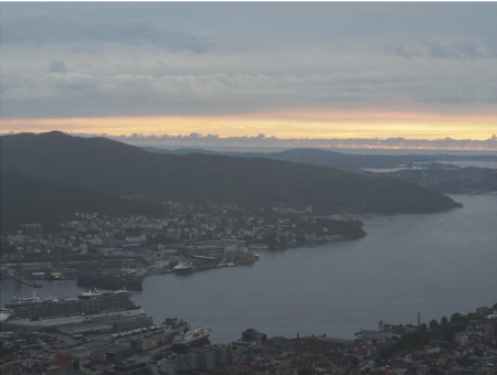
You arrive at the spectacular lookout over Bergen.


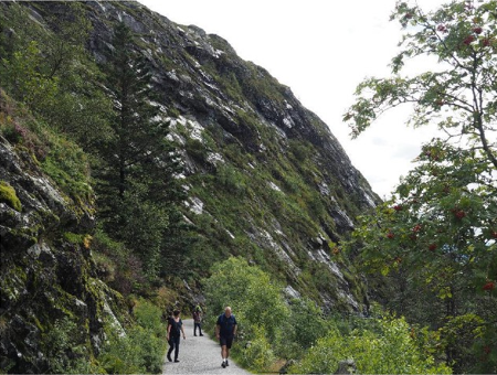
We headed off on one of the most popular walking trails to Brushytten for lunch.
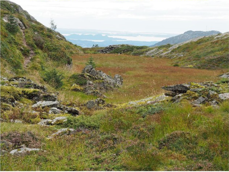
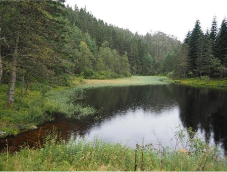
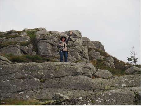
Next we climbed up the gravel track to Rundemanen.
According to Wikipedia:
“Rundemanen is a mountain in the city of Bergen in Hordaland county, Norway. It is considered one of the "seven mountains" which surround the city centre of Bergen. At 568 metres (1,864 ft) in height, it is the second highest of them all. It's a part of the same massif as the neighbouring mountains of Fløyen, Blåmanen, and Ulriken, but not easily visible from the city centre since it sits behind Fløyen.
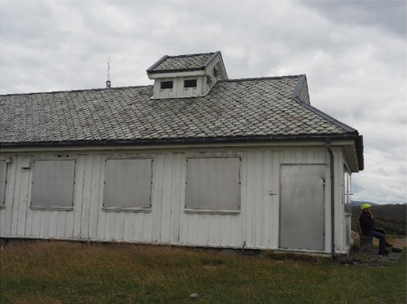
There were several buildings near the summit, some being the remains of a historic HF coastal radio transmitting station that commenced operation in 1927. It was closed in 2004 and was heritage protected in 2007.
There is also a large TV and microwave relay tower was still in operation on the top of the mountain.
It was late afternoon, so we decided to continue down the track and loopback to Fløyen.

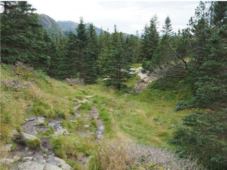
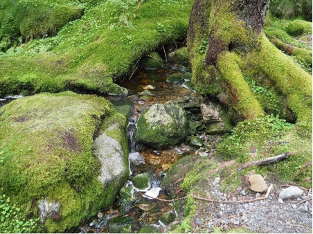
The well-defined gravel track degenerated into a vague path down the mountain through the
tussocks, across the bogs on duckboards and over the boulders and followed the power poles.
The ground was so rocky that the base of the power poles was sitting on a boulder, with steel stays bolted to the rocks supporting the pole.
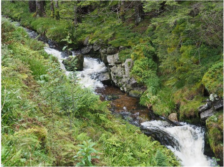
We came to a part where we were descending down the watercourse. By this time, we were using our walking sticks to steady our descent.

I find descending a rough track a lot harder than ascending, as you have to put your foot out into nothing and step down, hoping that you don’t overbalance or slip.

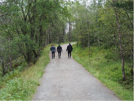
At the same time as we were gingerly picking our way down the track, we were being overtaken by younger people charging past.
We had the excuse that we were frequently stopping to take photos….

Down and down we went, as it was getting later and later and still no sign of the bottom.
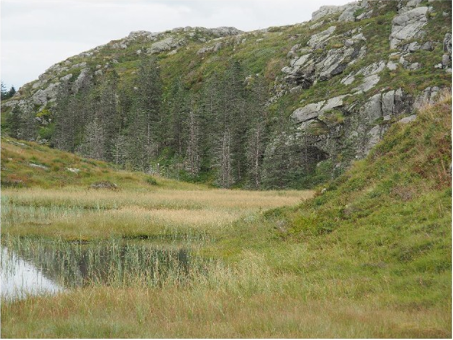
We diverted to take some photos of a lonely stone shack with a flagpole overlooking the fiords.
Getting to the shack meant crossing a watery bog on a board that sank just below the waterline as you walked upon it.
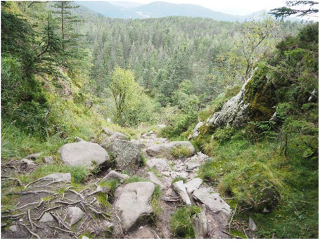
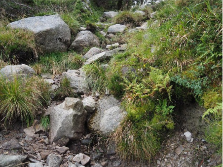
We re-joined the track, using footprints to identify the path. Here, the decent was rapid, over a
rocky cliff and down to the tree line at last.
That turned out to be a false dawn – now it looked like we had lost the path.
We were looking at a sharp depression in the edge of a cliff, with nothing but sky behind it.
According to Google maps on my phone, this was the path. It sharply descended the cliff and the rocks were covered in scree - small, loose rocks. We had no alternative, so we gingerly descended, a rock at a time, down, down to the bottom.
From there, the map showed that it was a short distance to a gravel road.
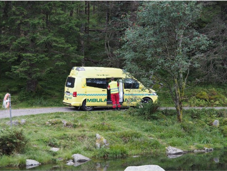
As we neared the road, I spotted an Ambulance. They loaded a tourist on board and it took off down the gravel road. We don’t know what happened, but it looked like someone had a mishap descending the track we were on.

We made it just in time - for now it started to rain.
When we looked up, we could see the narrow define in the edge of the rocky escarpment – did we really climb down there?
It was still a couple of kilometres over the lighted track back to Fløyen.
Some of the trails are lighted so that you can go on evening skiing trips!
It was still raining when we got back to Fløyen, so we abandoned our plans to walk down to Bergen and hopped on to the Fløibanen.

That night, I was going through our photographs and found the photos of a couple of mountain goats that they have penned just below the Fløyen observation platform.
I now know that they were actually staked out as a warning to foreign tourists – don’t stray from the main paths unless you can climb mountains like a Norwegian mountain goat!


Comments